
Map, framed
Object number2010.001.0001
Mediumpaper, mat board, wood, glass
DimensionsOther: 22.25 × 20 in. (56.5 × 50.8 cm)
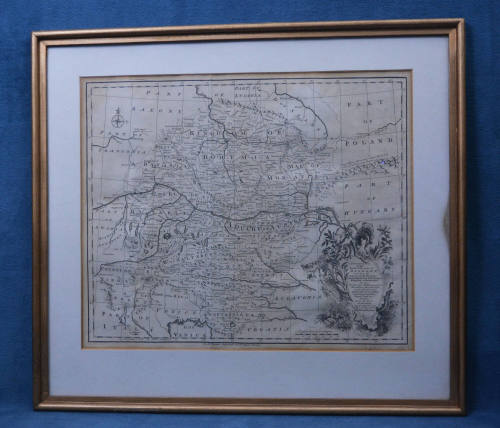
DescriptionA framed antique map described as "A Current Map of the South East Part of Germany; including the Electorate of Bavaria, ArchBishop of Salzburg & Kingdom of Bohemia. Also, the Queen of Hungary’s Hereditary Dominions in the Empire; viz. Austria, Moravia, Styria, Carinthia, Carniola, Trent, Tirol &c. Drawn from the best Authorities and adjusted by Astron. Observat. By Eman. Bowen". A line of text printed beneath the map reads, "For Mr. Tyndale’s Continuation of Mr. Rapin’s History". It is possibly dated to 1744. The map has white matting and is in a wooden frame covered with metallic gold paint.On View
Not on viewCollections